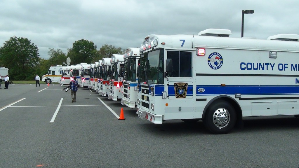
The EMSTF Medical Ambulance Bus Fleet stands at the ready if needed to assist during pre/post storm operations.
New York News | NYC Breaking News
The chances of an extremely powerful storm affecting New Jersey early next week have increased considerably, according to the National Weather Service.
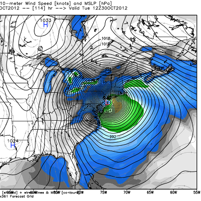
All eyes are fixed on now Hurricane Sandy, which is churning slowly northward in the southern Caribbean and expected to play a crucial role in the potential development of a powerful nor’easter that could begin affecting the Garden State as early as Sunday.
“The risk has gone up,” said Gary Szatkowski, the meteorologist in charge at the National Weather Service’s Mount Holly office. “This is a dangerous situation.”
Szatkowski said the number of forecast models and instruments indicating the possibility for New Jersey to be affected by a major storm have increased significantly since Tuesday. Under the worst-case scenario, Sandy could merge with a developing nor’easter, adding tropical moisture to an already powerful storm that would pummel New Jersey over several days with hurricane-force winds, torrential rain and severe coastal and inland flooding.
“I don’t like to call a storm historic before it happens, but if this comes together, we’ll be talking about it for a very long time,” said Steven DiMartino, owner of Freehold-based NY/NJ/PA Weather, part of Storm Surge LLC.
Szatkowski cautioned that much is still uncertain and forecasts can change in the coming days, but the potential for such a storm needs to be taken seriously.
“This is a very dangerous storm wherever it winds up. The problem is we don’t know where exactly it’s going to end up,” he said. “The East Coast has a pretty good shot at getting affected by this though, and that’s one of the reasons this needs to be taken very seriously.”
A number of factors are working against New Jersey as this situation develops, the weather service said.
First, the storm is expected to affect the region during a full moon, when tides are highest, increasing the possibility of major coastal flooding. Second, the storm is forecast to move very slowly through the region, potentially affecting the state with high winds and flooding rains for several days. Lastly, unlike a hurricane, winds can extend very far from the center of a nor’easter, increasing the chances the state could experience wind damage even if the storm develops farther off the coast.
“It makes you a bit nervous,” DiMartino said. “We’re dealing with something really unique here. This is going to be a hurricane merging and forming into a powerful subtropical storm. It’s something we haven’t seen in quite some time. We can’t jump the gun yet. But we’re talking about a storm with so many potential impacts. Just the coastal flooding threat alone is tremendous.”
https://www.facebook.com/pages/EMS-Task-Force-State-of-New-Jersey/113769656192


